project ref : 015
location : Mungasdale, 300m north of Gruinard House
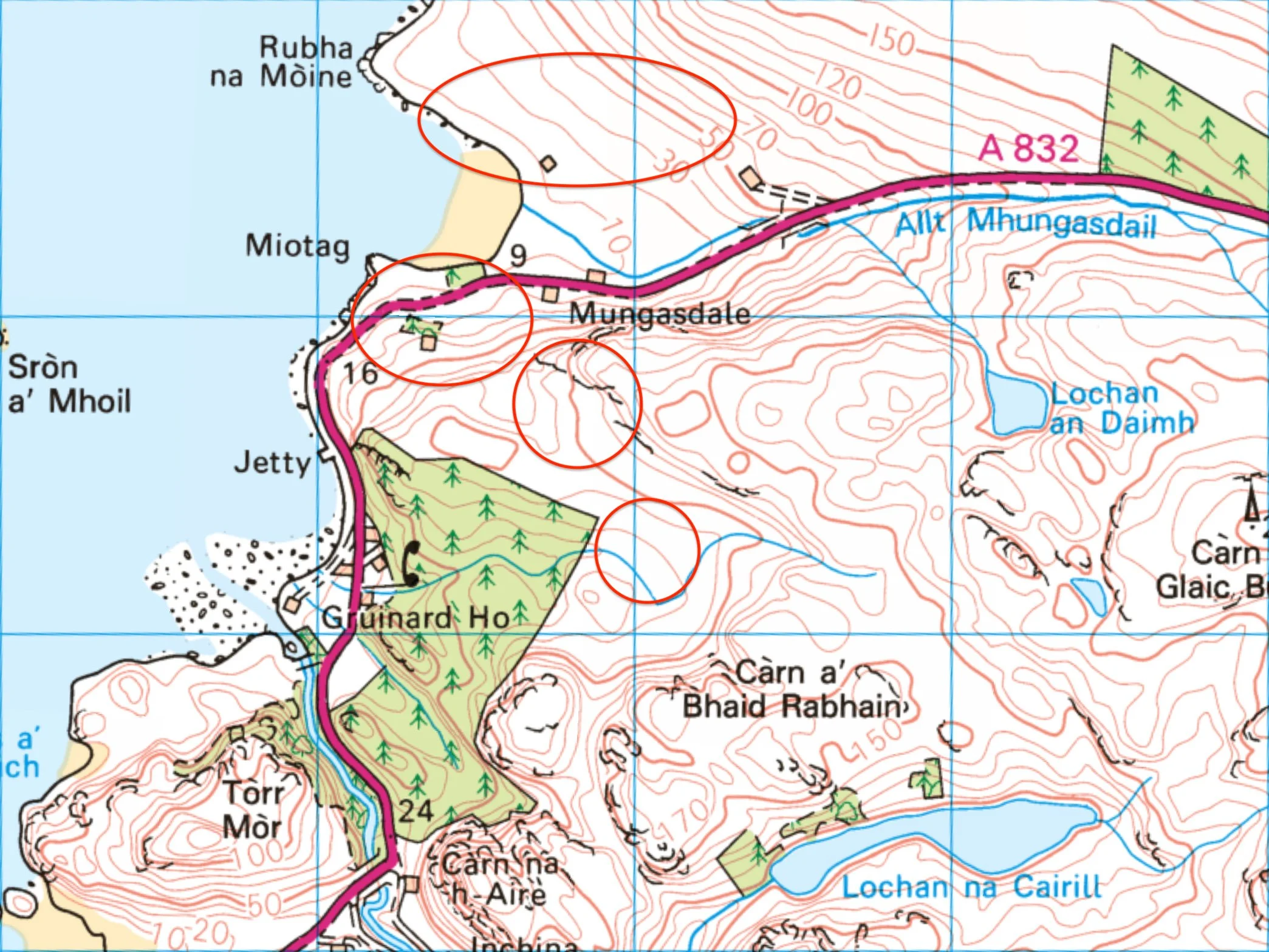
grid ref : several locations (Creag Mhòr Mhungasdail NG 9685 9280)
category : relatively modern farming landscape with shielings (19th century)
features : roundhouses, shielings, shieling huts, field system, enclosures, walls, dykes
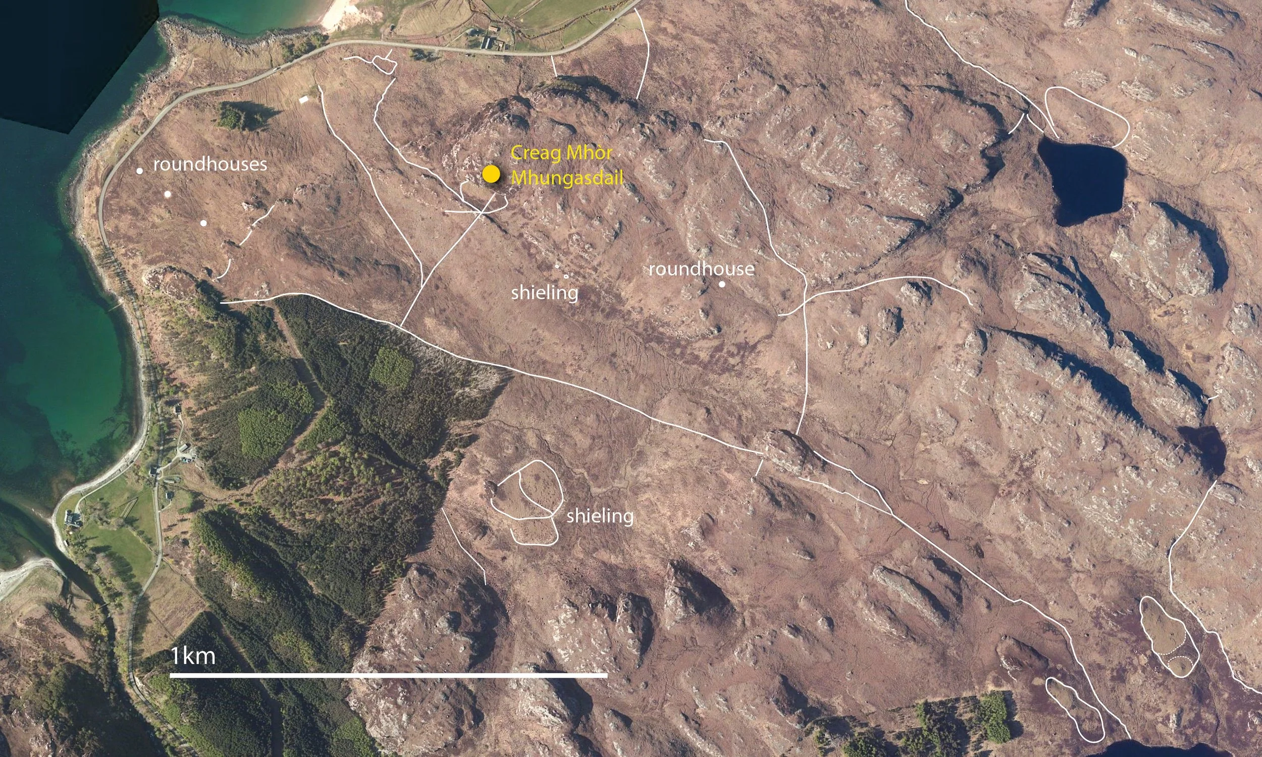
Mungasdale is just one small part of a large farming landscape stretching inland and linking other isolated settlements.
The extent of the dykes indicates livestock rearing (mainly sheep & some cattle).
Mungasdale
This aerial image shows a network of field walls, banks and dykes covering an area of 2 x 1 km.
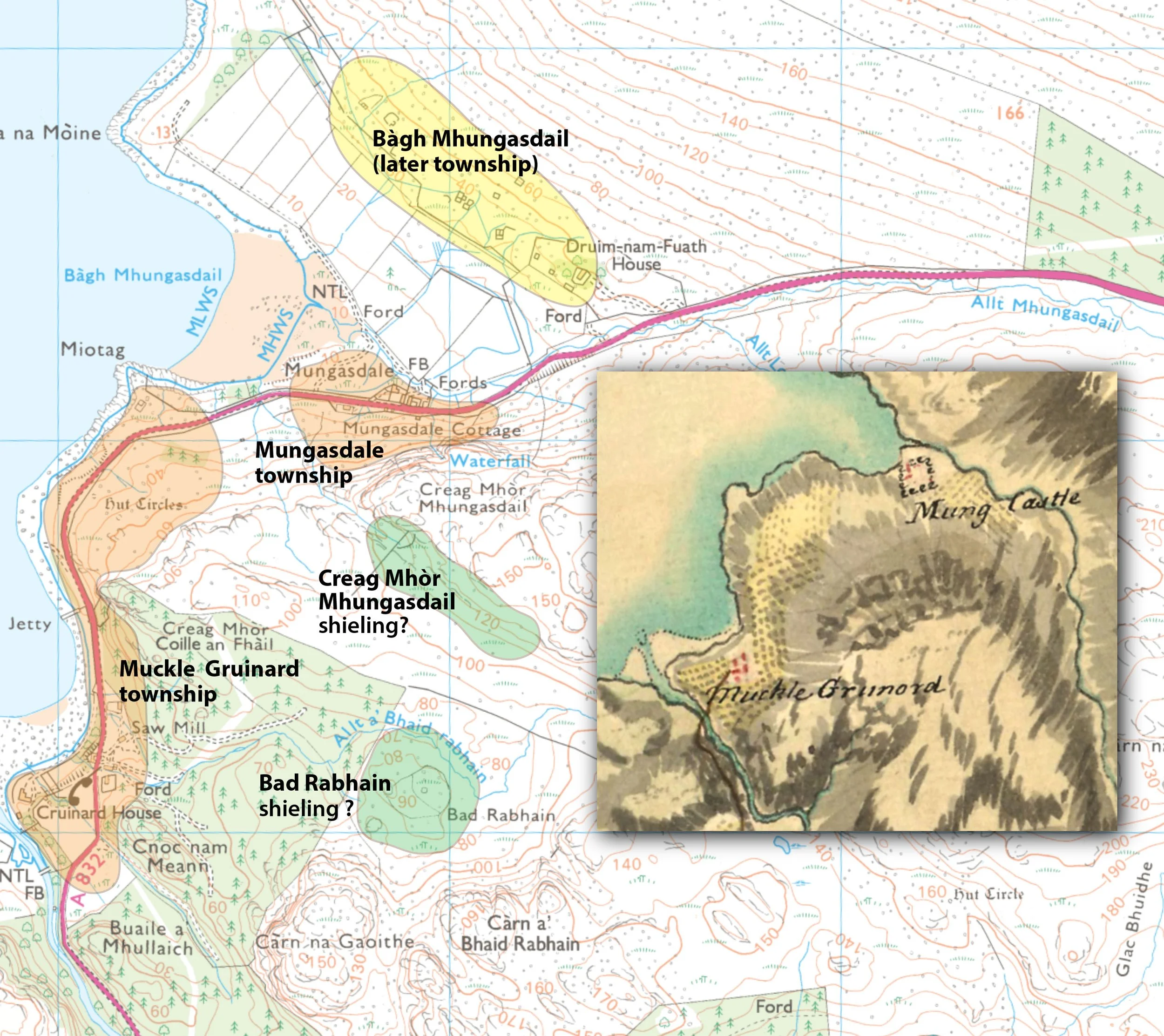
The map below includes a small section of Roy’s Military map (1747-1755) which shows two settlements, Muckle Grunord & Mung Castle. Mungasdale has obviously been verbally mis-interpreted by the cartographer as ‘mung-cas-tel’! Note that the township of Bàgh Mhungasdail did not exist at that time.
There are two possible shieling sites, with either Big Gruinard or Mungasdale as the parent townships. These shielings would presumably be out of use with the introduction of large numbers of sheep.
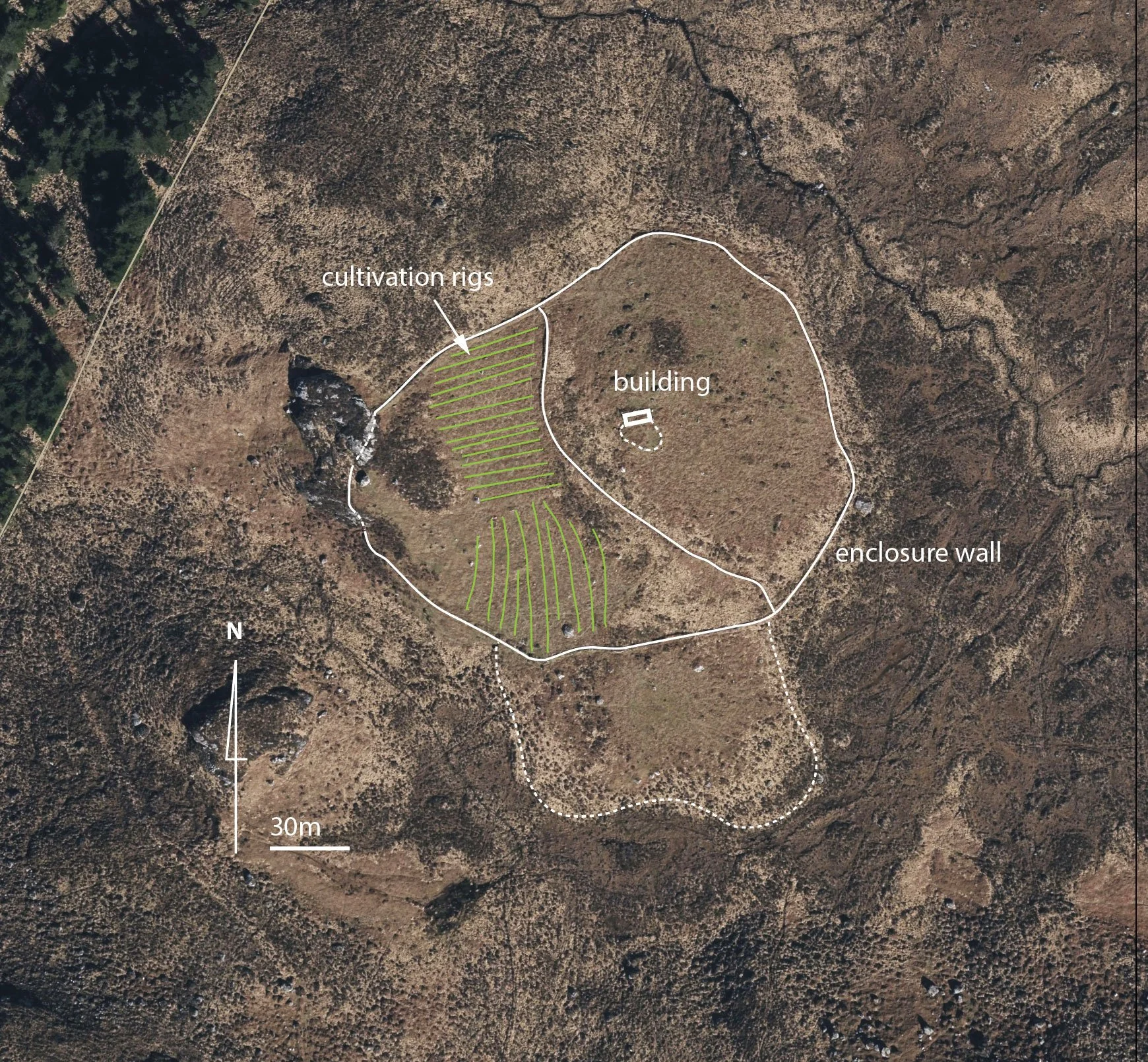
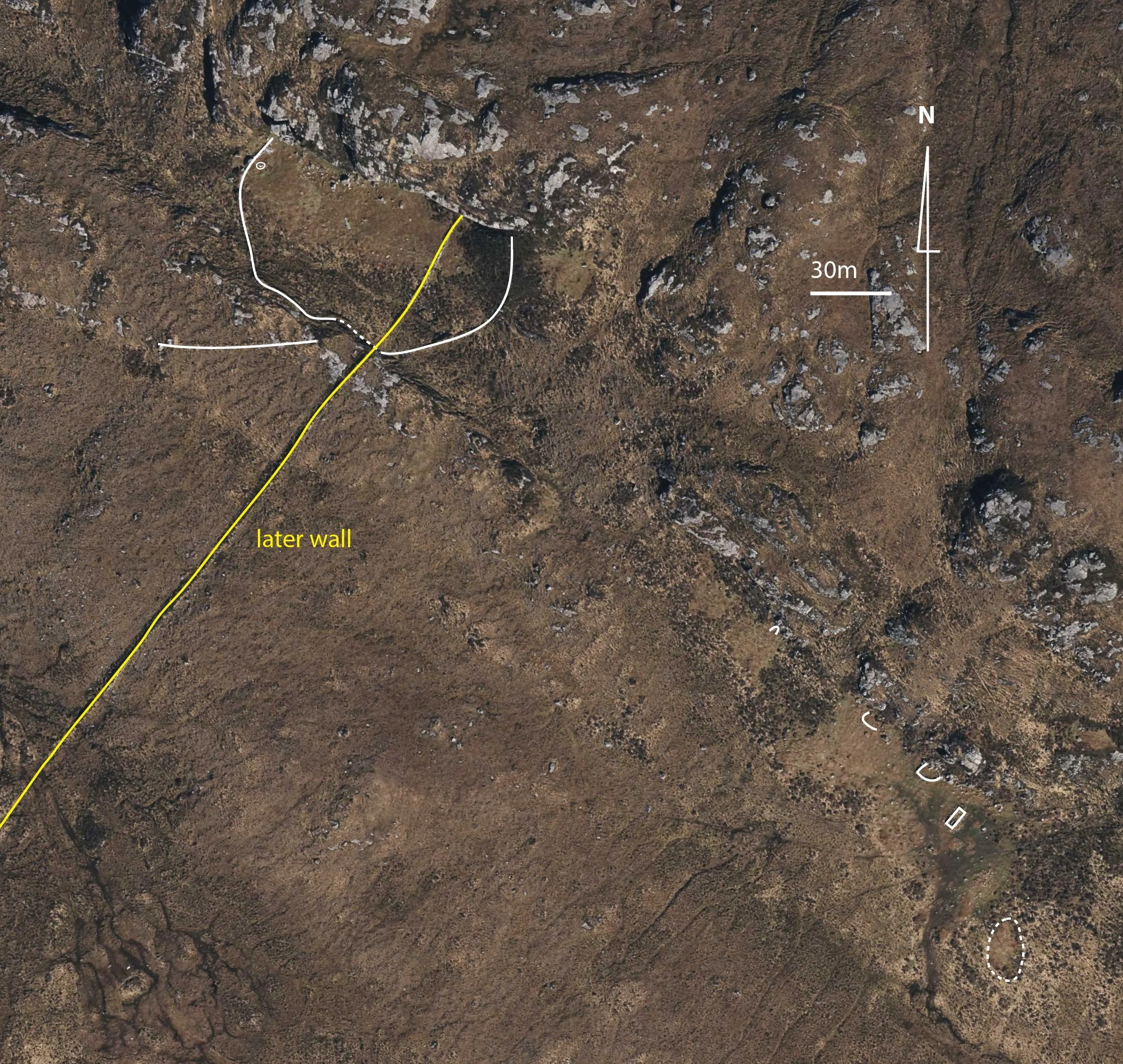
A possible shieling below the sheer rock face of Creag Mhòr Mhungasdail and extends SE, with a cleit and stock pens. There is also the remains of a building beside a jumble of boulders on a raised mound.
A long linear wall/bank has been added later, possibly to control the movement of large numbers of sheep.
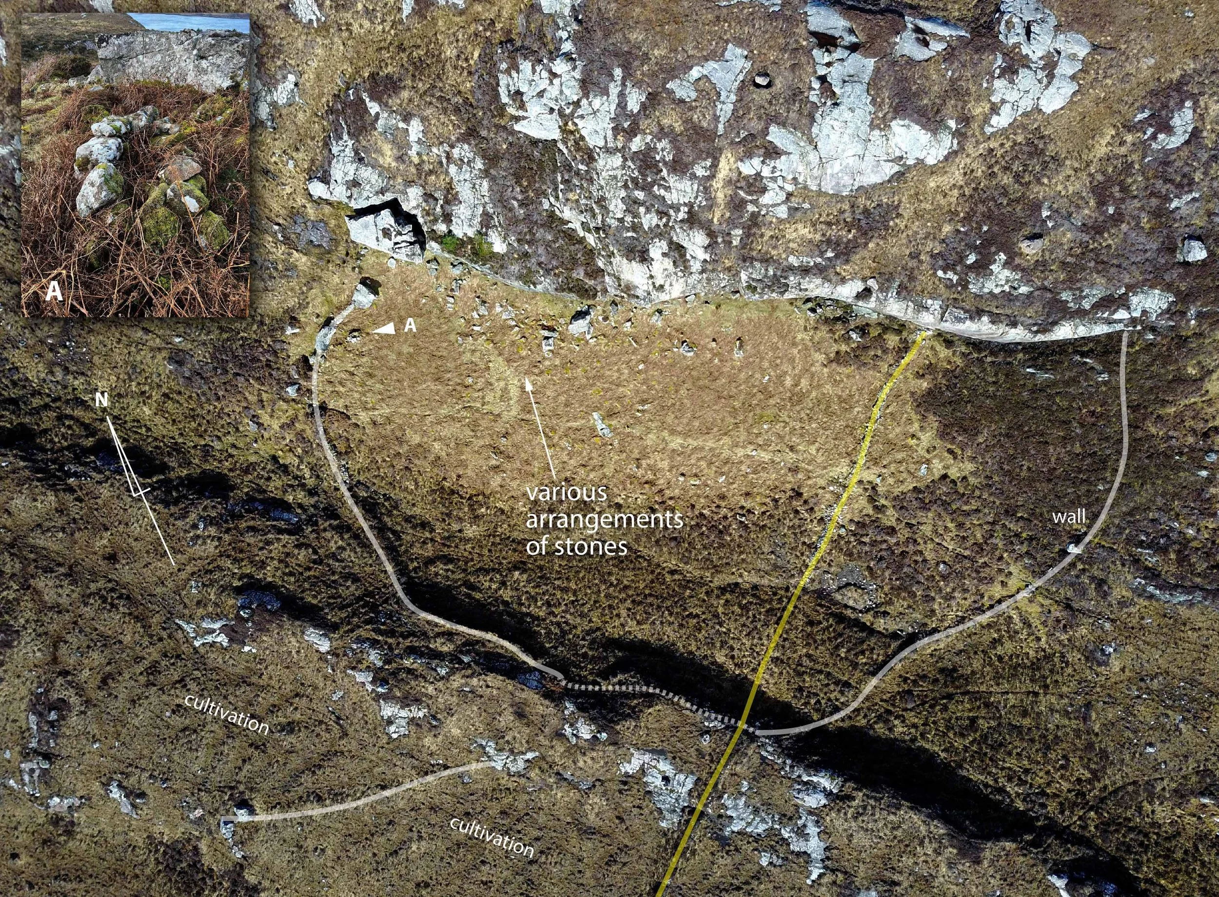
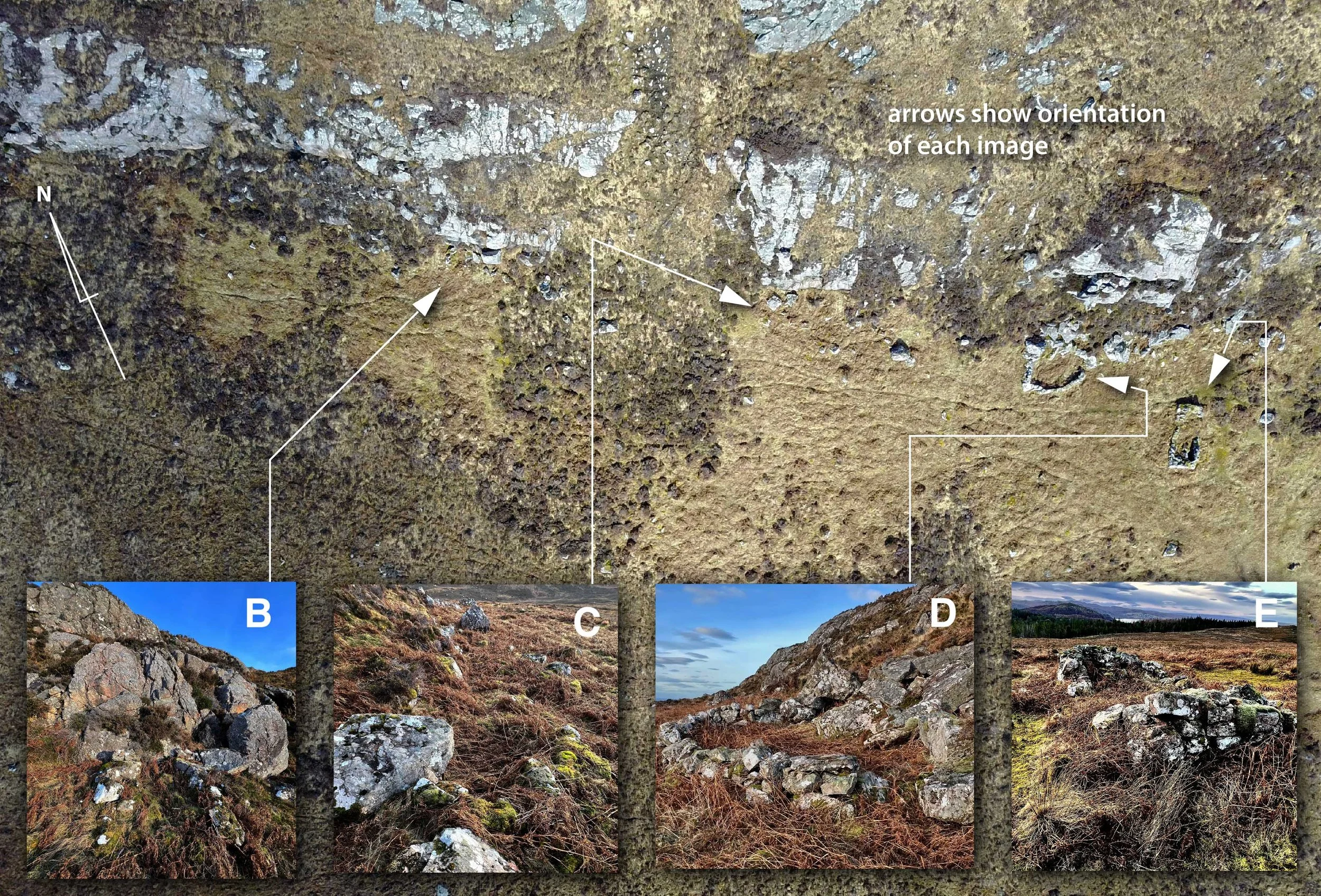
This sheltered enclosure has various arrangements of stones below the rock face. It is difficult to interpret as the bracken obscures any potential alignments.
There are at least 4 other features extending beyond the rock face. A cleit, stock pen, gathering pen & shieling hut.
Bad Rabhain is a possible shieling, with one shieling hut in a circular enclosure surrounded by a field wall/bank. The enclosure has been sub-divided by a wall/bank and the west section given over to cultivation.